27 Sep 2021
Nearly 50 years after the launch of the first Landsat satellite, Landsat 9 strikes a balance using state-of-the-art technology that will collect the highest quality data ever recorded by a Landsat satellite, while still ensuring that these new measurements can be compared to those taken by previous generations of the Earth-observing satellite.
The new satellite will add more than 700 scenes of Earth to the mission’s archive each day. A near-polar orbit will allow the satellite’s sensors to image almost the entire planet every 16 days. When Landsat 9 joins Landsat 8 in orbit, the two satellites together will be able to image each swath of the globe every eight days.
Landsat 9 carries two instruments that largely replicate the instruments on Landsat 8: the Operational Land Imager 2 (OLI-2) and the Thermal Infrared Sensor 2 (TIRS-2).
The OLI-2, built by the Ball Aerospace & Technologies Corporation, measures in the visible, near-infrared and shortwave infrared portions of the spectrum. Its images will have 15-meter (49 ft.) panchromatic and 30-meter multi-spectral spatial resolutions along a 185 km (115 miles) wide swath, covering wide areas of the Earth’s landscape while providing sufficient resolution to distinguish features like urban centers, farms, forests, and other land uses. The entire Earth falls within view once every 16 days due to Landsat 9’s near-polar orbit.
TIRS-2 measures land surface temperature in two thermal bands with a new technology that applies quantum physics to detect heat. The original TIRS instrument was added to the Landsat 8 satellite mission when it became clear that state water resource managers rely on the highly accurate measurements of Earth’s thermal energy obtained by its predecessors, Landsat 5 and Landsat 7, to track how land and water are being used. With nearly 80% of the fresh water in the western U.S. being used to irrigate crops, TIRS and TIRS-2 are invaluable tools for managing water consumption.
The instruments use Quantum Well Infrared Photodetectors (QWIPs) to detect long wavelengths of light emitted by the Earth, whose intensity depends on surface temperature. These wavelengths, called thermal infrared, are well beyond the range of human vision. QWIPs are a new, lower-cost alternative to conventional infrared technology and were developed at NASA’s Goddard Space Flight Center in Greenbelt, Maryland.
The QWIPs, TIRS, and TIRS-2 use are sensitive to two thermal infrared wavelength bands, helping it separate the temperature of the Earth’s surface from that of the atmosphere. Their design operates on the complex principles of quantum mechanics. Gallium arsenide semiconductor chips trap electrons in an energy state ‘well’ until the electrons are elevated to a higher state by thermal infrared light of a certain wavelength. The elevated electrons create an electrical signal that can be read out and recorded to create a digital image.
[Image]
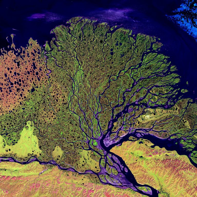
This image of the Lena River was made possible through Landsat. The Lena Delta Reserve is the most extensive protected wilderness area in Russia.